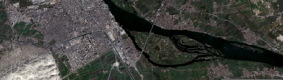

In my previous posts, I explained how to pan-sharpen and then mosaic Worldview-3 satellite imagery. The final phase of processing the 'ortho-ready' imagery is 'orthorectification'. To orthorectify the Worldview-3 imagery I used a 2m resolution digital surface model (DSM) generated by Digitalglobe from a stereo-pair of Worldview-2 satellite images of the same area of Middle …
Continue reading Orthorectifying Worldview-3 satellite imagery of Gebel Asyut el-Gharbi